


The uphill leg planned on the Ponsa terrain challenges both physical fitness and orienteering skills. The vegetation on the leg varies widely and green areas are mostly young deciduous forest with poor visibility, which makes orienteering more difficult and affects also running speed. On the other hand, the grey open rock areas are very fast with very good visibility.
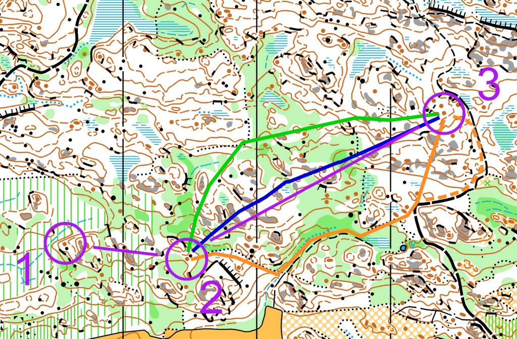
- Route from the right (orange line)
This route relies mainly on border lines and paths. At the end of the leg there are two different options – straight choice towards the control or a bit longer detour by the path. Orienteering-wise this is the easiest choice, but also the longest one with biggest number of climb meters.
- Route from the left (green line)
The left choice gives an opportunity to avoid the worst green areas and the ground is also quite flat with good runnability after the uphill part at the beginning of the leg. Orienteering-wise this is, however, challenging choice and good compass work is needed on the flat areas. Nevertheless, the biggest slopes are clear and can be seen from far ahead.
- Straight choice (blue line)
The straight option provides also quite difficult orienteering tasks. It can be difficult to maintain the right direction on the slope area, and on the green areas it probably is even more difficult. Therefore, good compass work is needed, and the clearest and biggest slopes on the leg are important to notice. On this choice, there are continuous uphills at the beginning and end of the leg, but some smaller climbs during the entire leg are increasing the total number of climb meters.